7 Breathtaking Colorado Fall Drives for Autumn Leaf Peepers ( + Maps!)
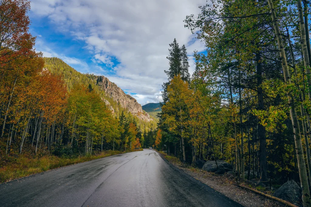
As the summer heat begins to fade and the leaves start to change, there’s no better time to hit the road and embark on at least one of these iconic Colorado fall drives through the Rocky Mountain’s vibrant autumn foliage. With its towering mountains, vast forests, and picturesque landscapes, Colorado offers some of the most breathtaking autumn views in the country.
From winding mountain passes to charming small towns nestled amidst golden aspens, this article will guide you through some of the best Colorado fall drives that promise unforgettable vistas of nature’s spectacular display during the fall season.
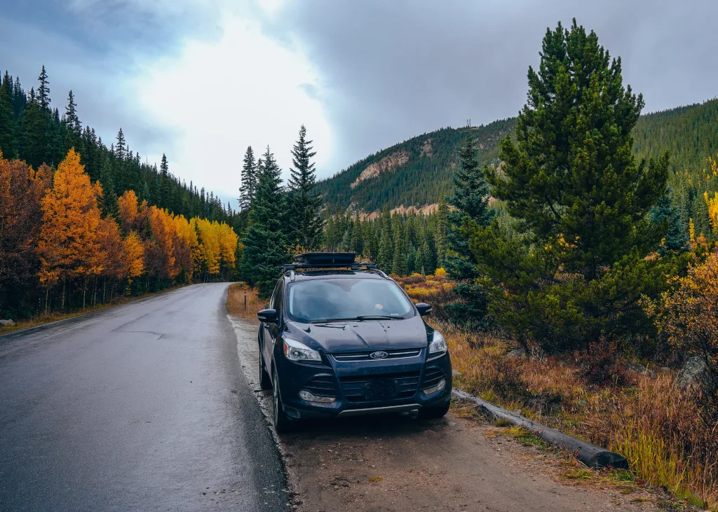
As Colorado locals, we drive these roads year-round to access some of our favorite hiking trails. In fall, these byways and highways come alive with golden-yellow aspen leaves, and we’re so excited to share these stunning Colorado fall drives with you!
7 Iconic Colorado Fall Drives
Please Respect Our Aspen Trees – Do Not Carve On Them!
While hiking in Colorado, you will likely notice many trees that have been carved into by other visitors. Please do not do this, as it permanently scars the tree and creates irreparable damage. Finding un-scarred aspen trees is getting more difficult as increased visitation leads to increased misbehavior. Keep these Colorado fall hikes pristine for years to come!
>>> Learn more about responsible outdoor adventuring at Leave No Trace.
1. Guanella Pass
Located near Georgetown, Colorado, Guanella Pass beckons travelers seeking an autumn adventure. The Guanella Pass scenic drive stretches approximately 22 miles, connecting Georgetown and Grant. As you navigate this route, a vibrant tapestry of golden aspens and deep-green evergreens unfolds around you, creating a captivating interplay of colors.
At the road’s summit, which reaches above the treeline at 11,669 feet, you’ll be able to see views of the forests below and Mount Bierstadt, one of Colorado’s 14ers, in the distance, on a clear day (we weren’t as lucky!).

- Length: 22 miles
- Vehicle Requirements: Any
- Nearest Town: Georgetown and Grant
- Nearby Adventures: Check out the Georgetown Loop Train for a scenic railroad trip through the fall foliage. Hike the Abyss Trail to Helms Lake, one of the best Colorado fall hikes.

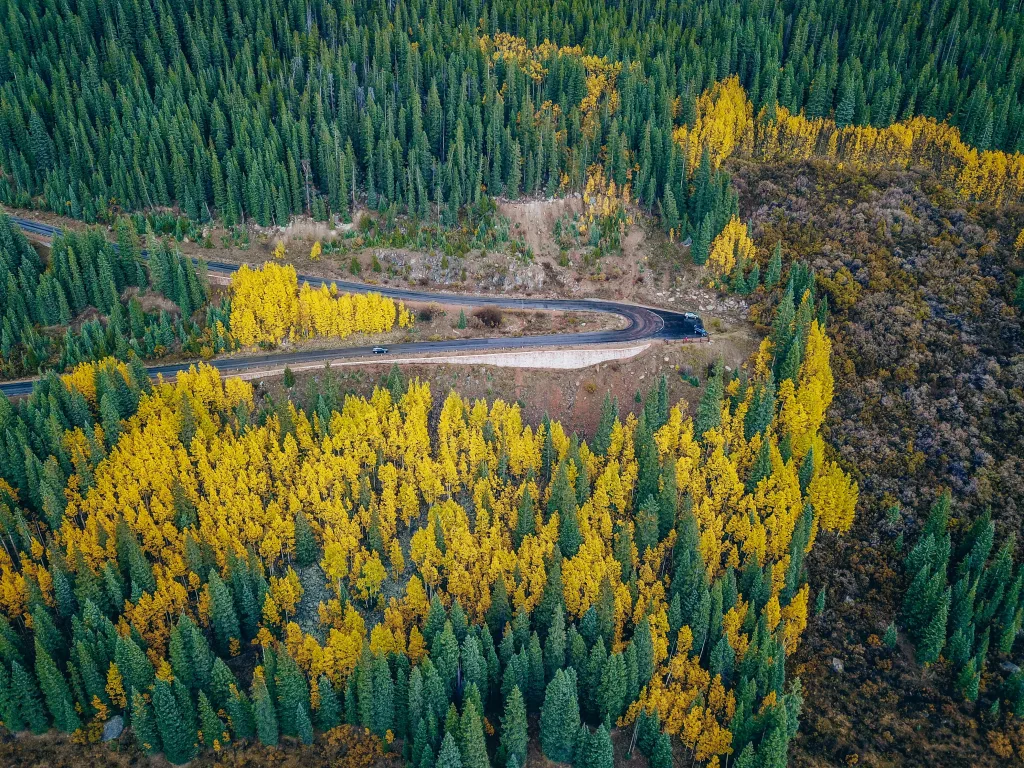
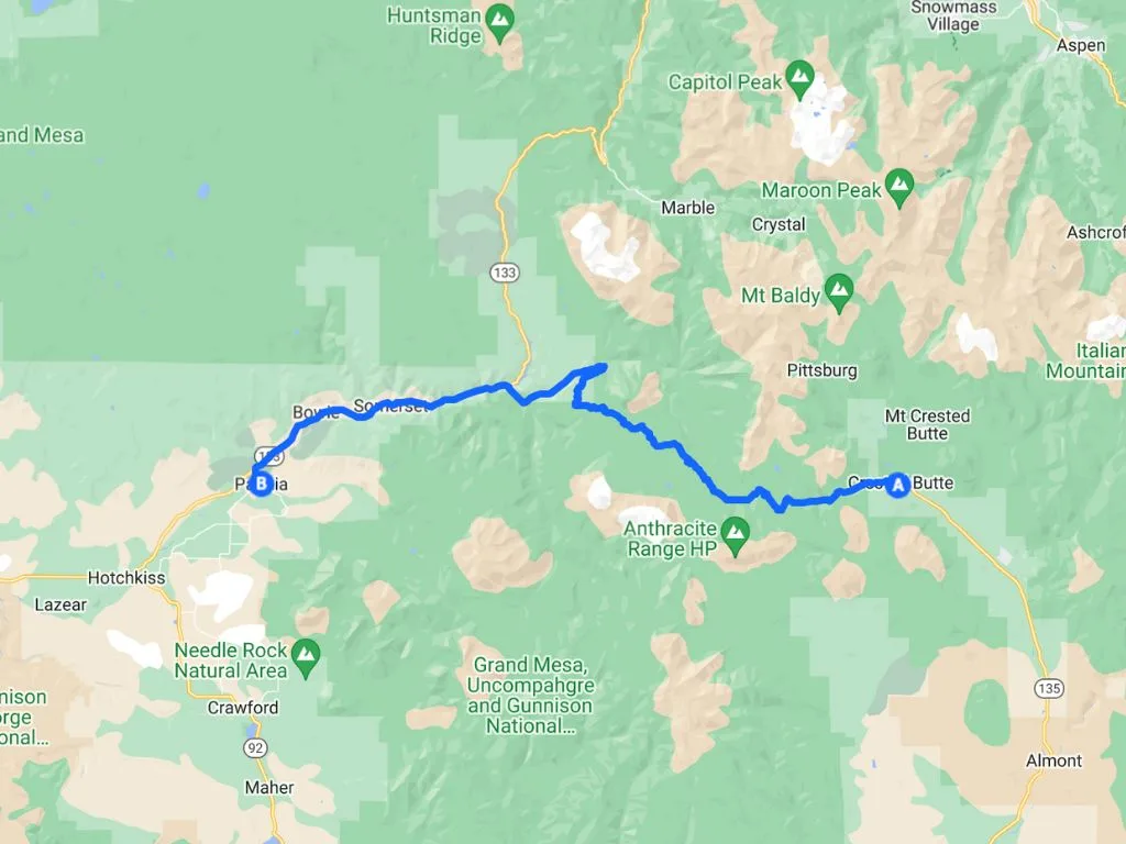
2. Kebler Pass
Tucked away in Colorado’s rugged expanse, Kebler Pass emerges as an unmissable gem for those in pursuit of an unforgettable fall expedition. Situated not far from Crested Butte, this hidden treasure promises a scenic drive that immerses you in the very heart of autumn’s brilliance. Spanning about 30 miles, the Kebler Pass route winds through a breathtaking landscape, connecting Crested Butte and Paonia.
- Length: 30 miles
- Vehicle Requirements: Any (road is graded gravel)
- Nearest Town: Crested Butte, Paonia
- Nearby Adventures: Hike the Three Lakes Trail from Lost Lake Campground and explore downtown Crested Butte.
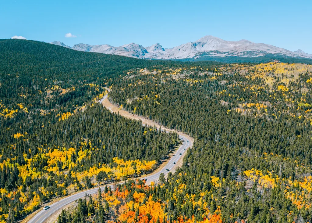
3. Peak to Peak Highway
The iconic Peak to Peak Highway spans 55 miles, weaving through the heart of the Rocky Mountains, and offers an exquisite front-row seat to Colorado’s fall colors. This Colorado fall scenic drive treats you to a symphony of colors, with golden aspen groves and evergreen forests. Along the way, iconic attractions await, such as the majestic Rocky Mountain National Park, where alpine lakes mirror the fiery foliage above, and the historic towns of Estes Park and Nederland, where local charm meets artistic spirit. You can make the drive in a day, or make a week-long road trip out of the Peak to Peak Highway to explore the towns, parks, and forests along the way.


- Length: 55 miles
- Vehicle Requirements: Any
- Nearest Town: Estes Park, Black Hawk
- Nearby Adventures: Explore Rocky Mountain National Park, visit quirky Nederland, and hike at Brainard Lake Recreation Area.
4. Independence Pass
Independence Pass stretches across the Sawatch Range, linking the towns of Aspen and Twin Lakes. At the pass’s pinnacle, the Continental Divide stretches before you, offering panoramic views that stretch to the horizon. The short paved trail from the parking lot is worth the effort! If you’re lucky, you might catch sight of local wildlife like mule deer and bighorn sheep. Keep in mind that the weather can change quickly at these elevations, so packing warm layers and checking road conditions beforehand is a wise move.
Note that Independence Pass closes in October for the winter.
- Length: 36 miles
- Vehicle Requirements: Any
- Nearest Town: Aspen, Twin Lakes
- Nearby Adventures: Hike the Grotto’s Trail in Aspen and the Interlaken Trail in Twin Lakes.

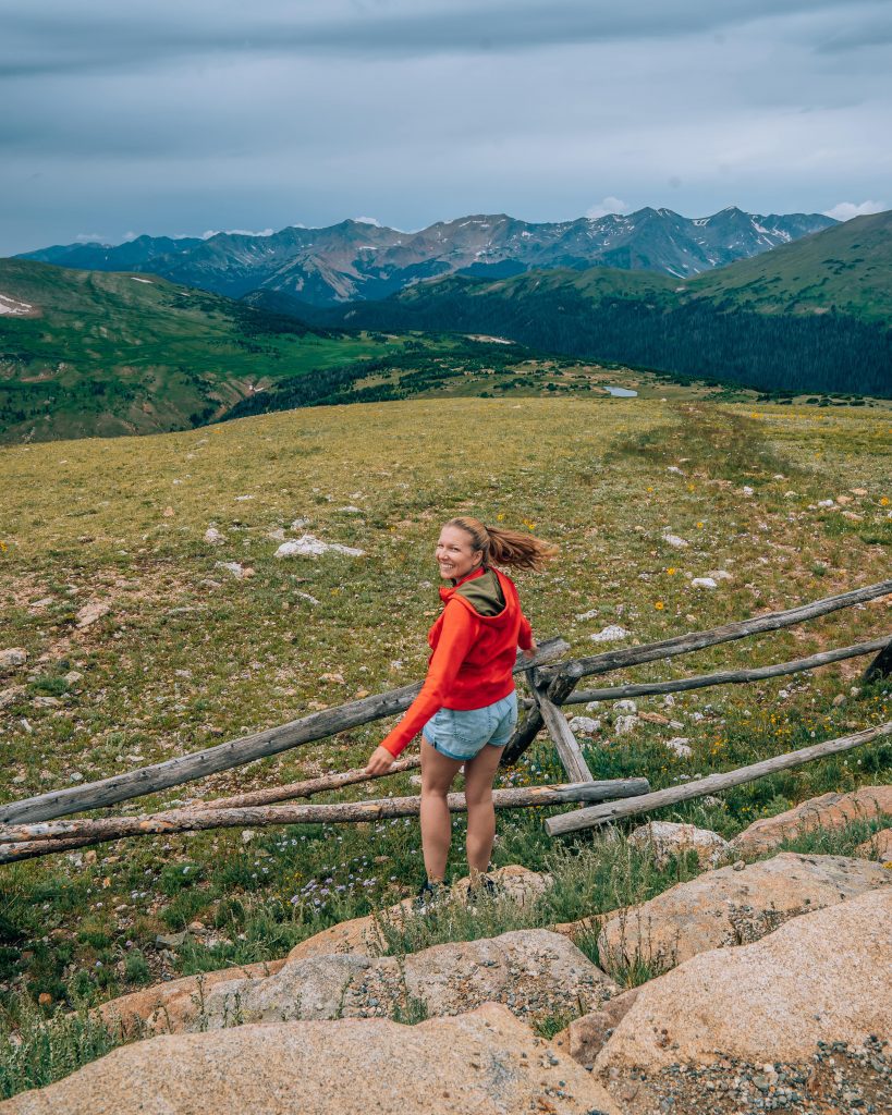
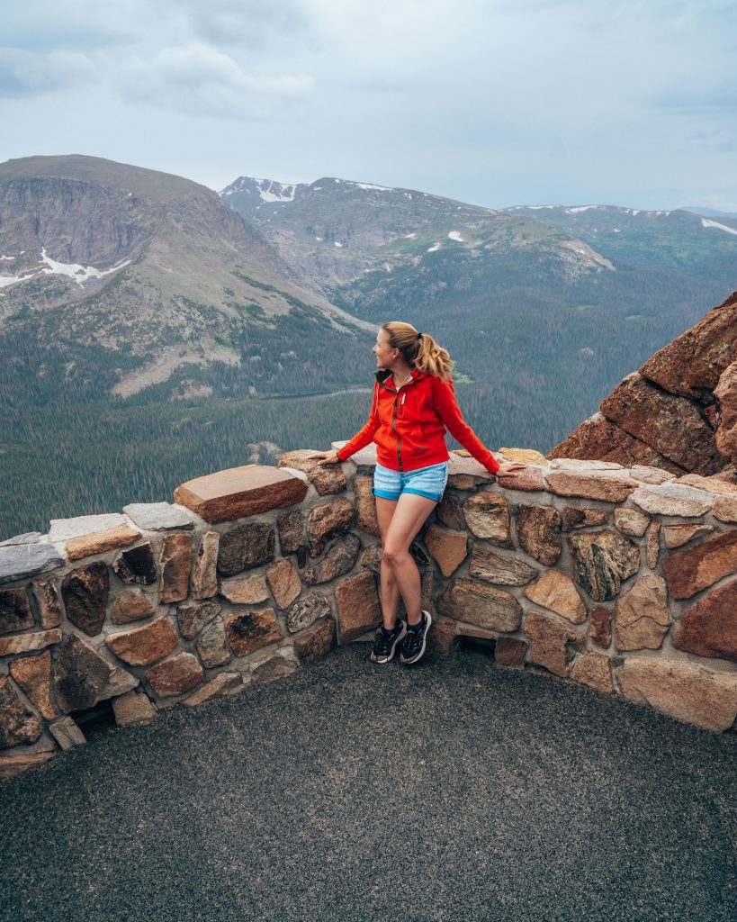
5. Trail Ridge Road
When fall blankets the Rocky Mountains with its fiery hues, Trail Ridge Road stands as an open invitation to witness autumn’s splendor at dizzying heights. Stretching across Rocky Mountain National Park, this scenic road journey takes you to elevations that offer a breathtaking perspective on the changing seasons. As you wind through the rugged terrain, you’ll find yourself immersed in a vibrant tapestry of colors – from the gold of aspen groves to the deep greens of evergreens. Keep an eye out for wildlife like elk and mule deer that often make appearances against this colorful backdrop. One of the highlights of the drive is Many Parks Curve, where you can savor sweeping views of mountain peaks and valleys painted in fall’s brilliance. Remember to bundle up, as temperatures can drop as you climb higher.

- Length: 48 miles
- Vehicle Requirements: Any
- Nearest Town: Estes Park, Grand Lake
- Nearby Adventures: Take a hike in Rocky Mountain National Park. We love hiking to Lake Haiyaha and the Loch, especially in fall!
- Fees/Permits: Timed-entry reservation is required to enter Rocky Mountain National Park between 9a and 2p until October 22, 2023. You can obtain this here. There is a $2 reservation fee, in addition to the park entrance fee of $35 per vehicle (good for 7 days), or free with a National Parks Pass.


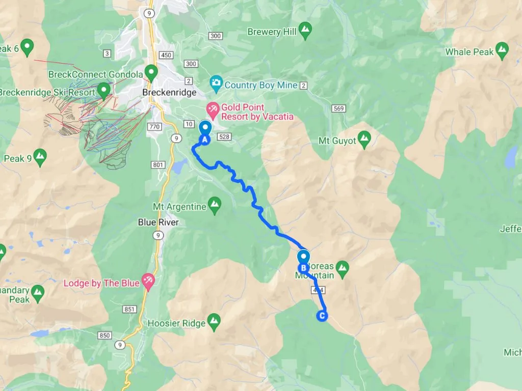
6. Boreas Pass
This historic route connects Breckenridge to Como and serves as a portal to fall’s enchanting beauty, making it a must-do among Colorado fall drives. As you ascend, a symphony of golden aspens and evergreens envelops the road. Along the drive, the old Boreas Pass Depot stands as a testament to the area’s rich history, providing a glimpse into the past. As you approach the Breckenridge side of Boreas Pass, you will get views of Quandary Peak, one of Colorado’s iconic 14,000-foot mountains.
- Length: 22 miles
- Vehicle Requirements: Any (mostly paved, then gravel as you go higher up).
- Nearest Town: Breckenridge, Como
- Nearby Adventures: Hike BB to Minnie Mine to Reiling Dredge, visit the Breckenridge Troll, and explore downtown Breckenridge.
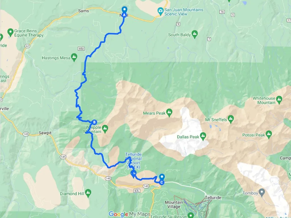
7. Last Dollar Road
Beginning near the picturesque town of Telluride and concluding at the iconic town of Ridgway, Last Dollar Road spans approximately 18 miles. The journey along Last Dollar Road is a tapestry of autumnal delights, with golden aspen groves lining the rugged dirt road. The sweeping vistas of the San Juan Mountains provide an awe-inspiring backdrop. Along the way, you’ll encounter old barns and historic structures that evoke the area’s ranching heritage, including the wooden barn and fence that served as the filming location for scenes in the John Wayne film True Grit.
While the road is mostly unpaved and can be bumpy in places, Last Dollar Road rewards travelers with the most authentic experience of the Colorado fall drives in this guide. Keep in mind that this road requires high-clearance vehicles and is best suited for those seeking an off-the-beaten-path adventure.
- Length: 18 miles
- Vehicle Requirements: 4×4 recommended
- Nearest Town: Telluride, Ridgway
- Nearby Adventures: Hike the Bridal Veil Falls trail, explore downtown Telluride, and ride the free gondola to Mountain Village!
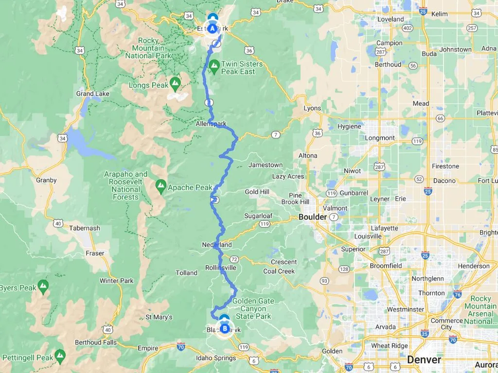
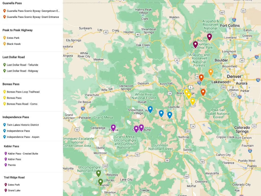
Colorado Fall Drives Map
Use this Google Map to plan your Colorado fall drives! Pins of the same color correspond to the same scenic drive.
Final Thoughts on Colorado Fall Drives
From the enchanting Guanella Pass to the heights of Trail Ridge Road, and the historic charm of Boreas Pass to the rustic allure of Last Dollar Road, each journey presents a unique perspective on fall’s breathtaking transformation.
Whether you’re drawn to the vibrant aspen groves, the majestic mountain vistas, or the touch of history embedded in the landscapes, Colorado’s scenic fall drives will make you fall in love with Fall-orado.
PS: Don’t miss our guide to the best Colorado fall hikes!