11 Best Hikes in Colorado National Monument
Planning a trip to Grand Junction, Colorado, and wondering what the best hikes in Colorado National Monument are? We’ve rounded up eleven of our favorite short and backcountry hikes in the park in this guide to the best hikes in Colorado National Monument.
Colorado National Monument, located in western Colorado near the border with Utah, is one of the best destinations on the Western Slope of the Rocky Mountains. The Monument, as it’s called, has a hiking trail suited for everyone, from short scenic overlooks to full-day backcountry treks.
To help you build your Colorado National Monument itinerary with hikes you’ll love, we’ve summarized 11 of the best trails with need-to-know information and local tips that will ensure you have an epic time!

Preparing for the Best Hikes in Colorado National Monument
Before we dive into the best hikes in Colorado National Monument, there are some key things you need to know about planning your trip first.
How to Get to Colorado National Monument
Colorado National Monument is located in Grand Junction in Western Colorado. You can get to Grand Junction by flying into the Grand Junction Regional Airport (GJT), which would be the closest airport to the Monument. It’s a small airport serviced only by American Airlines, United, and Allegiant Air, though, so you may find better flight options by flying into Denver International Airport (DEN) and driving 5 hours to Colorado National Monument. You will need to get a rental car either way since there is no public transportation in the park.
Your other option is to fly into Canyonlands Regional Airport (CNY) near Moab, Utah, and drive about an hour and a half to Colorado National Monument from there. CNY is also quite small, though, and only serviced by United and Delta, so we recommend comparing routes to all of these airports to find the best one for your trip!

Where to Stay When Visiting Colorado National Monument
There are a lot of options for where to stay near Colorado National Monument. Saddlehorn Campground is your best option within the park, and the towns of Palisade, Grand Junction, and Fruita are all good options just outside the park.
Saddlehorn Campground
Saddlehorn Campground within Colorado National Monument is definitely the most convenient location to stay when visiting CNM. The campground is located near the Saddlehorn Visitors Center. You can check Saddlehorn Campground reservations and availability online. The campground itself is a fantastic place to catch the sunset in Colorado National Monument.
Hotels in Fruita, Palisade, and Grand Junction
Fruita, Palisade, and Grand Junction are all excellent bases for a sunrise or sunset trip to Colorado National Monument. Fruita and Grand Junction hug either end of CNM, and Palisade is just outside Grand Junction and a great choice for those who want to see Colorado’s wine country as well.
Grand Junction Hotels
- Hotel Maverick
- Courtyard by Marriott Grand Junction
- SpringHill Suites by Marriott Grand Junction Downtown/Historic Main St.
- Fairfield Inn and Suites by Marriott Grand Junction Downtown
- Days Inn by Wyndham Grand Junction
Palisade/Wine Country Hotels
Fruita Hotels
Colorado National Monument Entrance Fees
Colorado National Monument, like many sites managed by the US National Park Service, charges a fee to enter. For one vehicle for 7 days, that fee is $25. For a motorcycle, the fee is $20. For pedestrians or bicyclists, it’s $15. In all cases, though, you can use an annual national parks pass like America the Beautiful pass to get entrance to the park at no extra cost. We buy one every year and recommend it to everyone who is planning to visit more than 3 national park locations in a 12-month period.
What to Pack For Hiking in Colorado National Monument
Hiking in the desert has special considerations compared to hiking in moister climates. That means you need to keep the dry and harsh environment in mind when preparing for the hiking trails in Colorado National Monument.
- Day Pack: It’s important to have a good day pack to carry everything you need on a hike. I’ve had the Osprey Skimmer 20 for Women for years and it’s held up on every adventure! And here’s the Osprey Talon 22 Pack for Men!
- Water Reservoir: If your day pack doesn’t have a water reservoir in it already, you can buy one separately to slip into your bag. These are so important for staying hydrated and comfortably carrying several liters of water with you for desert hikes! Here are our favorite 2-liter reservoir and 3-liter reservoir!
- Sun Protection: This is so important no matter the season! Many of the hikes in Colorado National Monument have limited shade. There aren’t many trees, and the canyon is very exposed to the sun. Sun Bum is our favorite sunscreen brand.
- Hiking Boots: I hiked Colorado National Monument in my Columbia hiking boots. You can’t beat the price for the quality, too. Tim wore his Foxelli boots and swears they are the best hiking boots he’s ever owned.
- Socks: I started wearing these double-layer Wrightsock brand socks when marathon training years ago and have never gotten a blister with them!
- Sunglasses: I love these wooden frame sunglasses, so they are my go-to.
- Hiking pants: These hiking leggings are my favorite in winter. In summer, I usually hike in biker shorts or leggings.
- Hat: It’s important to protect your body from the sun when hiking in Colorado National Monument. That’s why we recommend a wide-brimmed hat to shade your face and neck or at least a baseball cap to shade your face.
- First Aid Kit: An ultralight first aid kit is a must-have for every hike, but especially challenging ones like this where it’s even more important to be prepared in case of injury.
- Camera: I always hike with my Sony a7iii. It’s a great full-frame camera for capturing all of our hiking memories!
- Snacks: Clif Energy Bars are our favorite hiking snack, for a good mix of carbs, fats, and protein to power us through our hikes!
- Trekking poles: Many people like hiking with trekking poles to offset the burden on the knees, especially going downhill. We don’t use ours often, but these Black Diamond Trail Back hiking poles are really popular!
When is the Best Time of the Year to Hike in Colorado National Monument?
We think fall and spring are the best seasons to hike Colorado National Monument. Temperatures are mild both day and night, making it a pleasant time of the year to hike in the desert!
Summers are SCORCHING hot with temperatures regularly exceeding 90 degrees Fahrenheit in June, July, and August. This is why we don’t recommend hiking in Colorado National Monument in the summer.
Winter high average temperatures range from 38-56. Expect mornings and nights to be chilly and days to range from cold to mild. We’ve compiled average high and low temperatures for Grand Junction, Colorado below!

The 11 Best Hikes in Colorado National Monument
We have grouped Colorado National Monument’s best hikes into two groups: Rim Rock Drive Hikes and Backcountry Hikes. While a backcountry permit is not required for the day hikes in the backcountry, we find this grouping useful for understanding the risk level on each hike. Within each group, we have listed the best hikes in Colorado National Monument in order of difficulty, starting with the shortest and easiest hikes, and building up to the longest and most difficult. Keep reading to learn why we think these are the best hikes in Colorado National Monument!
Rim Rock Drive Hiking Trails (Short Hikes in Colorado National Monument)
Below are the best hikes in Colorado National Monument that are located along Rim Rock Drive. These hikes are generally easy, flat, and short.
1. Window Rock
| Distance: 0.5 miles Elevation: 60 feet | Time: 15 minutes Difficulty: Very easy |
Window Rock Trail Summary
The short and sweet Window Rock trail was the first “hike” we did in Colorado National Monument. I put hike in quotes because really this wide and relatively flat path is suitable for non-hikers too! The trail provides a great view into Monument Canyon in the south and over the cities to the north. At the end of the trail, you will come to a yellow metal fence. This is the main overlook into Window Rock, which is basically a natural hole in the rocks! This is a great trail for sunset, as well, with spectacular views of the Independence Monument, Praying Hands, Kissing Couple, and other formations in the canyon below!
Bucket List Moments
- See a natural “window” or hole in the rocky cliffs overlooking the canyon floor!
- This is likely your first stop and hike in Colorado National Monument, so enjoy your first look at the awe-inspiring rock formations within the canyon!
Local Pro Tips
- While the Window Rock trail gives you an awesome close-up view of the hole in the rock, we prefer the view of the window from the Book Cliffs Viewpoint behind the Saddlehorn Visitor Center.
- This trail can easily be combined with the Canyon Rim trail to the visitor center. We have more details on this trail below (see number 3).
2. Alcove Nature Trail
| Distance: 0.9 miles Elevation: 45 feet | Time: 30 minutes Difficulty: Very Easy |
Alcove Nature Trail Summary
This is an excellent orientation trail to the Colorado National Monument. The Alcove Nature trail leaves from the Saddlehorn Visitor Center, so it’s a perfect short trail to visit after checking out the exhibits in the Visitor Center. True to the trail name, there is a small alcove at the furthest point of the trail.
Bucket List Moments
- This is a very family-friendly trail that even young kids can handle. Since it doesn’t approach the canyon rim, you don’t need to worry about them getting too close to a steep edge. Enjoy seeing the Monument through their eyes!
Local Pro Tips
- Don’t skip the Colorado National Monument Visitor Center, which shares a parking lot with the Alcove Nature Trail. The Park Rangers always have good information to share, including current happenings in the park and advice on how to make the most of your visit.
3. Canyon Rim
| Distance: 1.8 miles Elevation: 246 feet | Time: 50 minutes Difficulty: Easy |
Canyon Rim Trail Summary
The Canyon Rim Trail is the best bang for your buck when it comes to trails in the Saddlehorn Visitor Center area. Not only will you get to walk along the rim of Monument Canyon, where you can admire Independence Monument, Praying Hands, Kissing Couple, and other formations in the canyon below, you will also get to see the Book Cliffs View and the best view of Window Rock. When you reach the Window Rock overlook, just turn back the way you came to return to the Colorado National Monument Visitor Center.
Bucket List Moments
- Visit the Saddlehorn Visitor Center, enjoy epic canyon views, and take in both the Book Cliffs and Window Rock views all on one short trail.
Local Pro Tips
- Keep an eye on your kids on this trail, since it does follow the canyon rim (as the name suggests!).

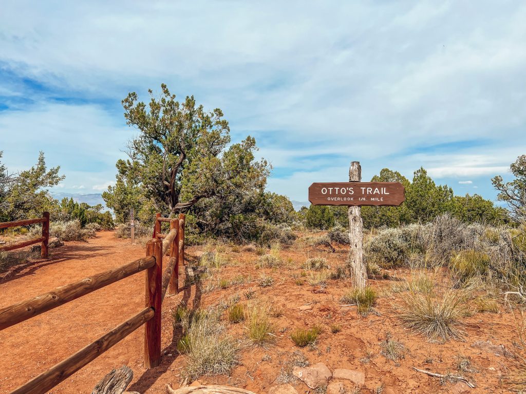
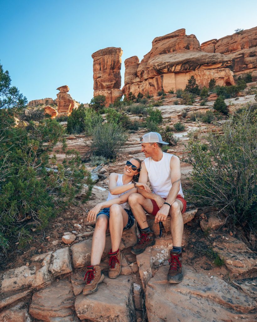
4. Otto’s Trail
| Distance: 0.7 miles Elevation: 124 feet | Time: 30 minutes Difficulty: Easy |
Otto’s Trail Summary
Otto’s Trail is another one of our favorite hikes in Colorado National Monument. It’s named for John Otto, the first park ranger for the Monument, and the person who advocated most vehemently for the area’s designation as a National Park. While the area is not technically a National Park, its designation as a National Monument means it is protected and can be enjoyed for recreation. You will notice many landmarks named for or by John Otto in the park.
The trail has a gradual slope and leads through a small forest of pinyon-juniper to an overlook showcasing Sentinel Spire, Pipe Organ, Praying Hands, and Independence Monument. You’ll know you’ve arrived when you get to the fenced-in overlook!
Bucket List Moments
- Otto’s Trail is one of the best places to watch sunset and sunrise in Colorado National Monument! Our guide to enjoying the sunrise and set in the Colorado National Monument has more information on how to best enjoy the most magical times of the day in the Monument!
Local Pro Tips
- Check out our blog post about the short hike to the Otto’s Trail overlook for everything you need to know!


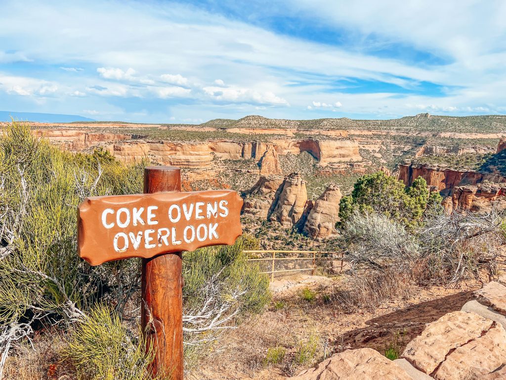
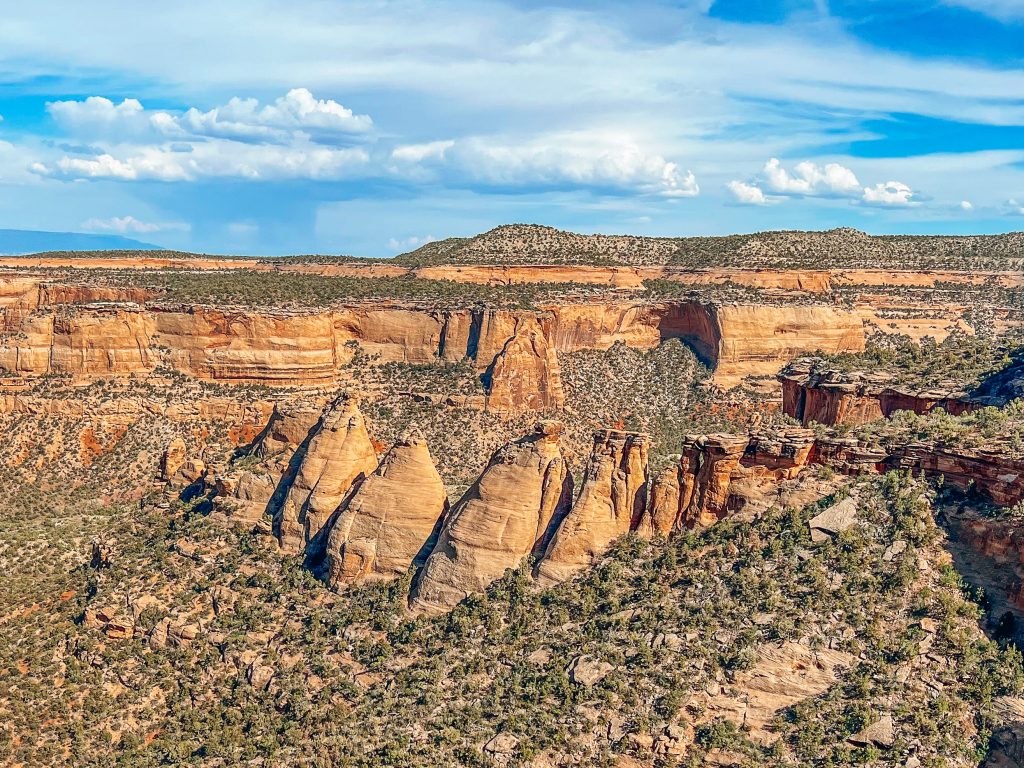
5. Coke Ovens
| Distance: 1 mile Elevation: 173 feet | Time: 30 minutes Difficulty: Easy |
Coke Ovens Trail Summary
We love the Coke Ovens trail because it offers one of the most unique views in Colorado National Monument. Don’t get us wrong, we love the giant monoliths in Monument Canyon, but there’s something mysterious about the perfectly conical beehive-shaped rock structures known as the Coke Ovens! Not actually ovens at all, the formations get their name due to their resemblance to the ovens historically used in coal production.
Bucket List Moments
- The Coke Ovens Overlook and Trail is the best place to see the unique beehive formations found nowhere else along Rim Rock Drive.
Local Pro Tips
- Don’t miss the small “cave” on your right as you near the end of the trail. It’s a small wash under the road and doesn’t lead anywhere, but provides a fun photo op and frame for capturing photos of the coke ovens!

6. Serpents Trail
| Distance: 3.4 miles Elevation: 780 feet | Time: 2 hours Difficulty: Moderate |
Serpents Trail Summary
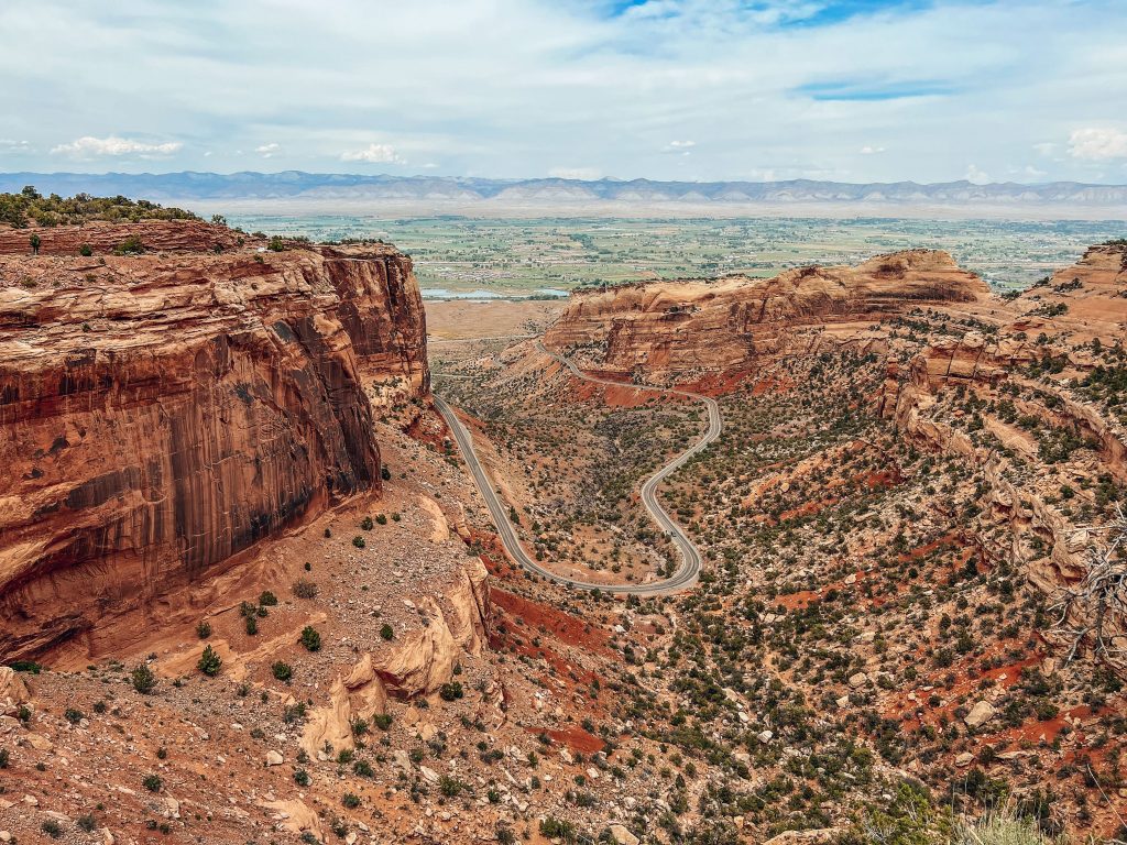
Before there was Rim Rock Drive, there was the Serpents Trail. The first road for tourists into the park, Serpents Trail was built by John Otto in the early 1900s and remained the main road until 1950. Now a hiking trail, it has 16 switchbacks and an elevation change of 780 feet.
Bucket List Moments
- Walk in the steps of the earliest visitors to Colorado National Monument along the very first road into the park. Imagine cars driving backwards up the road in the 1900s – the only way vehicles at the time could make the steep ascent!
- Brag to your friends about you hiked the “crookedest road in the world”.
Local Pro Tips
- Hike in the morning or at dusk for a chance to see the trail’s resident bighorn sheep!
- If you’re looking for a serious workout, Serpents Trail is a beloved climb by trail runners.
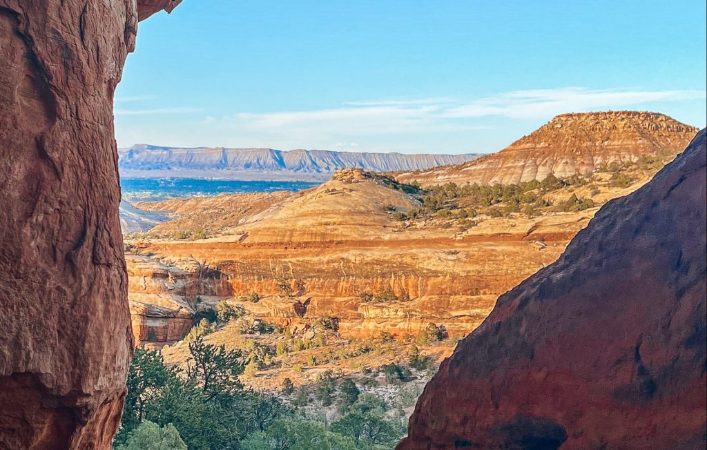
7. Devils Kitchen Hike
| Distance: 1.9 miles Elevation: 403 feet | Time: 1 hour Difficulty: Moderate |
The Devils Kitchen Trail is our favorite hike we’ve done so far in Colorado National Monument. It starts on a flat dirt path into No Thoroughfare Canyon with immediate views of the towering red rock cliffs around you. The trail ascends gradually until you get to the rock-hewn steps which lead up a slightly steeper trail to the rock formation for which the trail earns its name.
Bucket List Moments
- Catch the sunset in the canyon to see the Devils Kitchen light up in a golden glow.
- Hike Devils Kitchen in the spring to see the desert flowers blooming on the canyon floor.
Local Pro Tips
- The trail gets a bit hard to find the further into the canyon you go. We recommended downloading a map in advance on the CO Trex app (free app and map downloads) or All Trails (free app with downloads available on a paid plan). Unless you already have a pro All Trails account, we recommend using Co Trex since it’s free and it’s the official app of Colorado Parks and Wildlife.
- When you get to the Devils Kitchen rock formation, it’s easy to miss the entrance into the grotto! Be sure to walk up the slick rock to your left to get to the front of Devils Kitchen and go inside. More details on how to find the “kitchen” are in our super-detailed blog post about the Devils Kitchen hike!


Best Backcountry Hikes in Colorado National Monument
While these hikes in Colorado National Monument do not require a backcountry permit, they are technically in the Monument’s backcountry. In general, these hikes are longer and more exposed than the short trails on Rim Rock Drive, and most of these go deep within the canyons of the park. We have not yet hiked any of the backcountry trails, but if we had our pick of which to do first, it would be the iconic Monument Canyon!
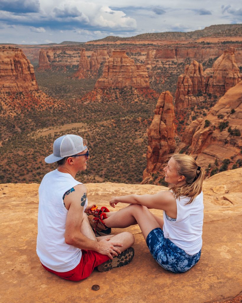
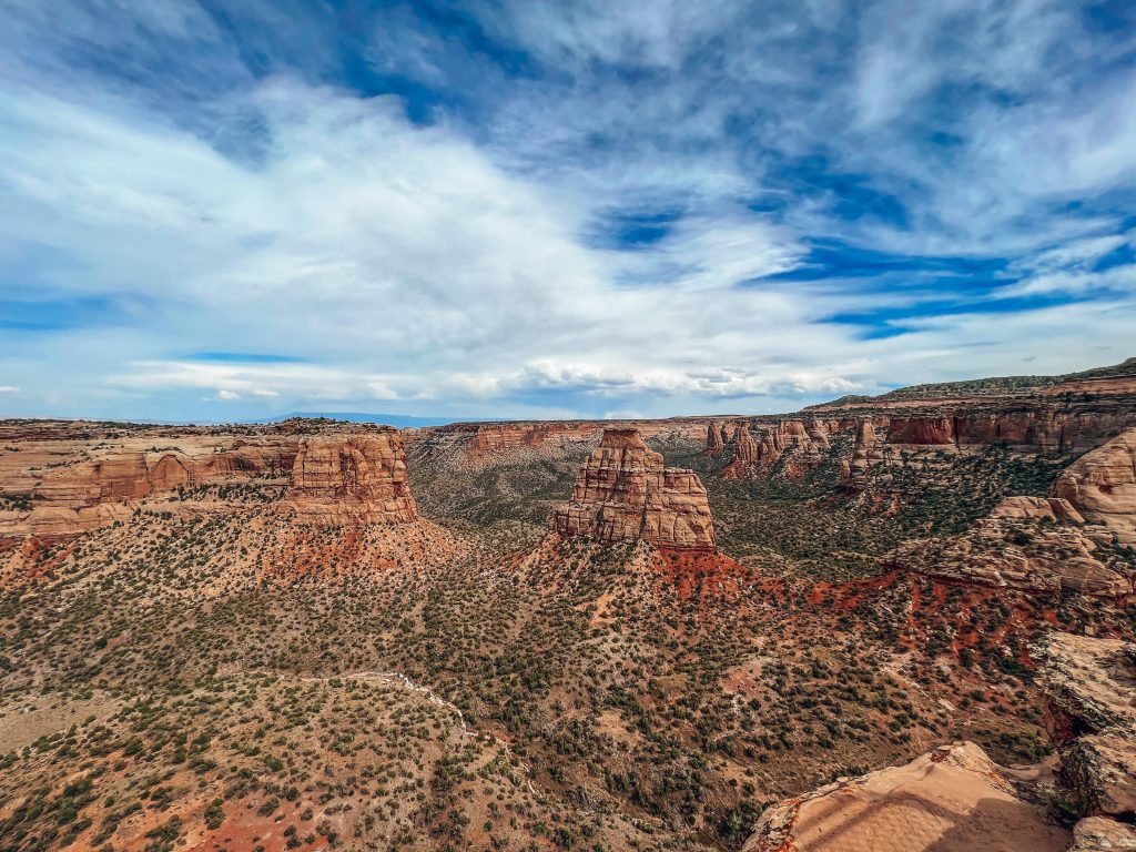
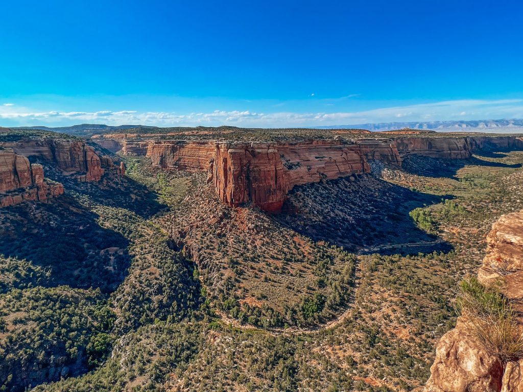
8. Monument Canyon
| Distance: 11.6 miles Elevation: 1873 feet | Time: 5.5 hours Difficulty: Moderate |
Monument Canyon Trail Summary
The most popular backcountry trail in Colorado National Monument, the Monument Canyon trail is the best way to immerse yourself in the grandeur of the canyon and truly appreciate the size and scale of the monoliths that dot the canyon. You can start this hike either at the same trailhead as the Coke Ovens trail mentioned above on Rim Rock Drive or from the trailhead off Highway 340 near the west entrance.
Bucket List Moments
- Walking among giants on the Monument Canyon floor for a grounds-eye view of the Independence Monument, Kissing Couple, Coke Ovens, and others.
Local Pro Tips
- Cut the hike in half by arranging transportation to pick you up at either the upper or lower trailhead (depending on where you start and finish).
- Start your Monument Canyon hike on Rim Rock Drive to hike downhill rather than up. If you decide to do the hike one-way, this means you don’t have to make a grueling ascent.
9. Liberty Cap
| Distance: 12.9 miles Elevation: 2004 feet | Time: 6 hours Difficulty: Difficult |
Liberty Cap Trail Summary
This long and challenging hike to the top of the Liberty Cap rock formation is on many people’s Colorado National Monument bucket lists. Like the Monument Canyon trail, there are several trailheads for Liberty Cap so you can choose whether you want to start with a descent or with a climb. In addition to climbing Liberty Rock, you’ll get great views of the other monuments in the canyon.
Bucket List Moments
- Stand on the top of Liberty Cap, one of the few rock formations in Colorado National Monument that doesn’t require technical climbing to ascend.
- Climb the ladder John Otto, Colorado National Monument’s first park ranger, installed into the rock in the park’s early days to reach the top of Liberty Cap!
- Watch for bighorn sheep on this hike!
Local Pro Tips
- At 14 miles round trip, the Liberty Cap trail is quite long. We recommend hiking one way to shorten your trek to 7 miles and arranging transportation from the trailhead at the other end.
- This trail is very steep if you start one of the lower trailheads, but much easier from the upper trailhead.
10. No Thoroughfare Canyon
| Distance: 5.6 miles Elevation: 793 feet | Time: 2.5 hours Difficulty: Moderate |
No Thoroughfare Canyon Trail Summary
The No Thoroughfare Canyon trail, in the southern portion of Colorado National Monument, is one of the park’s most unique hikes. Very few other places in the Monument feature waterfalls, after all. Other highlights of this moderately difficult half-day hike are caves, pools, streams, and rock formations.
Bucket List Moments
- See waterfalls in the desert!
- Explore No Thoroughfare Canyon’s caves
Local Pro Tips
- The best time of the year to see the water flowing is spring when the snow is melting!
11. Ute Canyon
| Distance: 11 miles Elevation: 1912 feet | Time: 5.5 hours Difficulty: Moderate |
Ute Canyon Trail Summary
The highlight of this moderately difficult backcountry hike in Colorado National Monument is the arches you can see along the way. The Ute Canyon trail crosses the canyon floor of one of the Monument’s three large canyons. You will pass by rock formations like Liberty Cap as you hike beneath the sandstone cliff walls.
Bucket List Moments
- See some of the natural arches that make this region one of the most arch-dense areas on earth. (PS: If you love rock bridges and arches, don’t miss Rattlesnake Arches just outside of Colorado National Monument!
Local Pro Tips
- Start your hike at the upper trailhead on Rim Rock Drive and arrange for someone to pick you up at the lower trailhead to avoid a steep ascent!
Map of the Best Hikes in Colorado National Monument
I’ve compiled all of the hikes on this list of best hikes in Colorado National Monument, plus a few bonus trails, into a helpful map for you to plan your trip! As you can see, a lot of the trailheads are very near one another, so if it’s your first visit to Colorado National Monument, we recommend doing several short hikes along Rim Rock Drive for a full and exciting day in the park! Our one-day itinerary for Colorado National Monument has great information on how to make the most of a 1-day visit to the park.
Final Thoughts on the Best Hikes in Colorado National Monument
Whether you are an experienced hiker looking for a challenge or a beginner looking for canyon views, Colorado National Monument has an epic hike for everyone! Be sure to put this beautiful park on your Grand Junction, Colorado bucket list, and don’t forget to check out our other Colorado National Monument blog posts to help you plan your best trip!
- Colorado National Monument Itinerary
- Driving Scenic Rim Rock Drive
- Otto’s Trail
- Coke Ovens Trail
- Devils Kitchen Trail
- Best Sunrise and Sunset Spots in Colorado National Monument
- Rattlesnake Arches