Everything You Need to Know to Plan the Perfect Scenic Drive on Trail Ridge Road

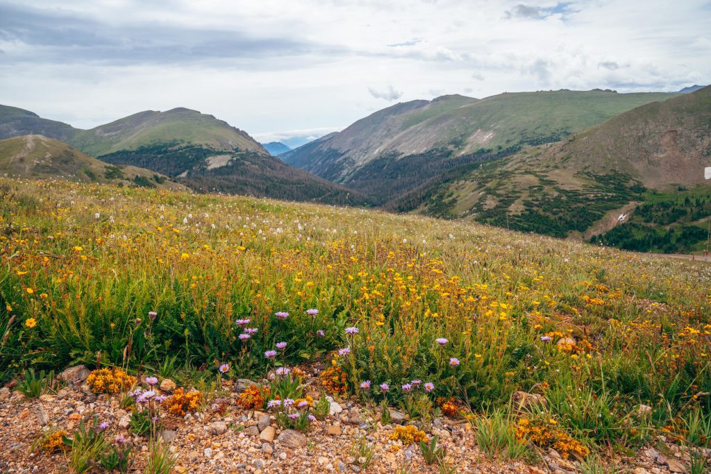
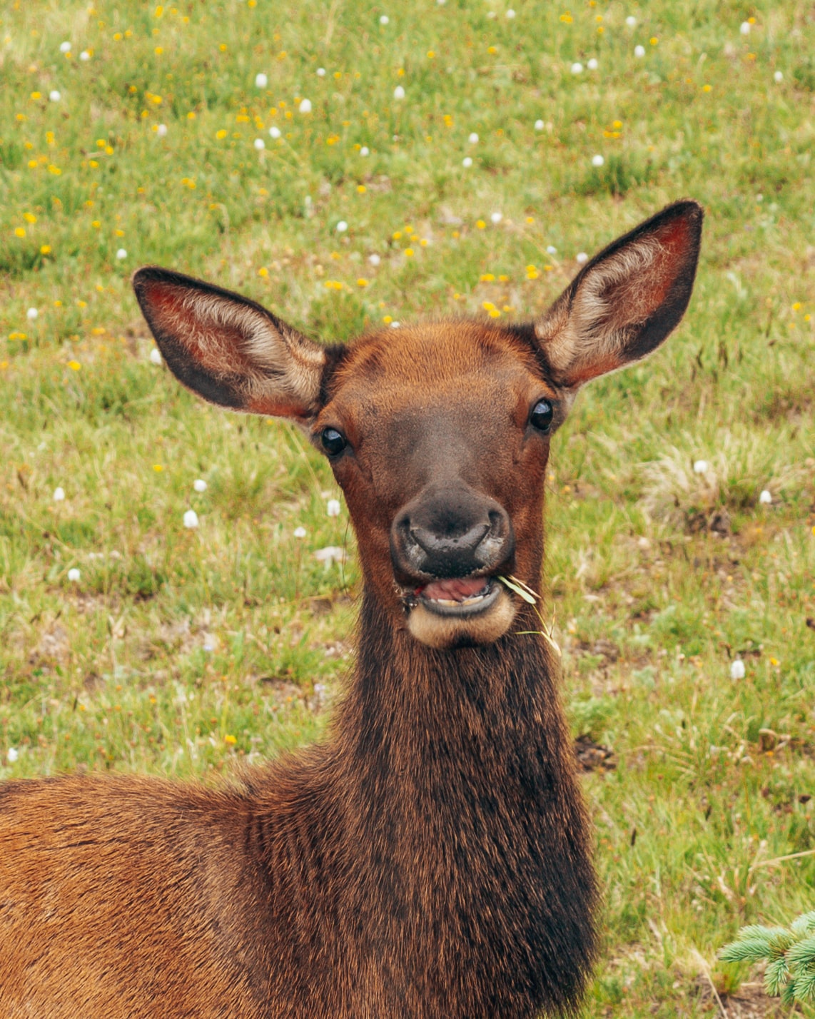
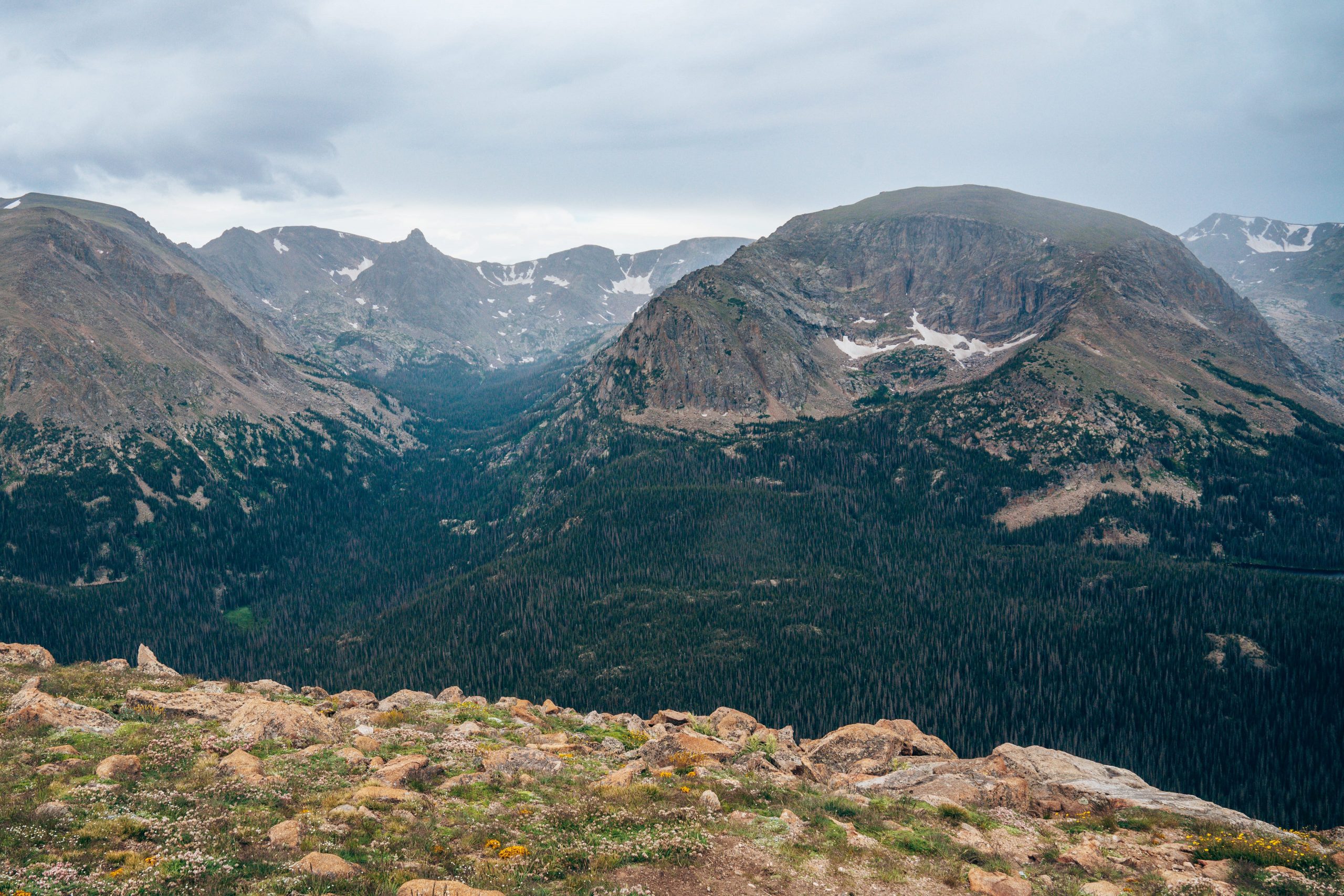
Driving Trail Ridge Road is one of the best things to do in Rocky Mountain National Park, and one of the most scenic drives in the United States! Connecting the towns of Estes Park in the east to Grand Lake in the west, Trail Ridge Road winds 48 miles over mountain passes, past countless miles of hiking trails, the Continental Divide, and the source of the mighty Colorado River. There are breathtaking alpine views throughout the journey, as well as fields of wildflowers, forests, and tundra. We think this is one of the best drives to spot Colorado wildlife. We frequently see moose, elk, and bighorn sheep on Trail Ridge Road!
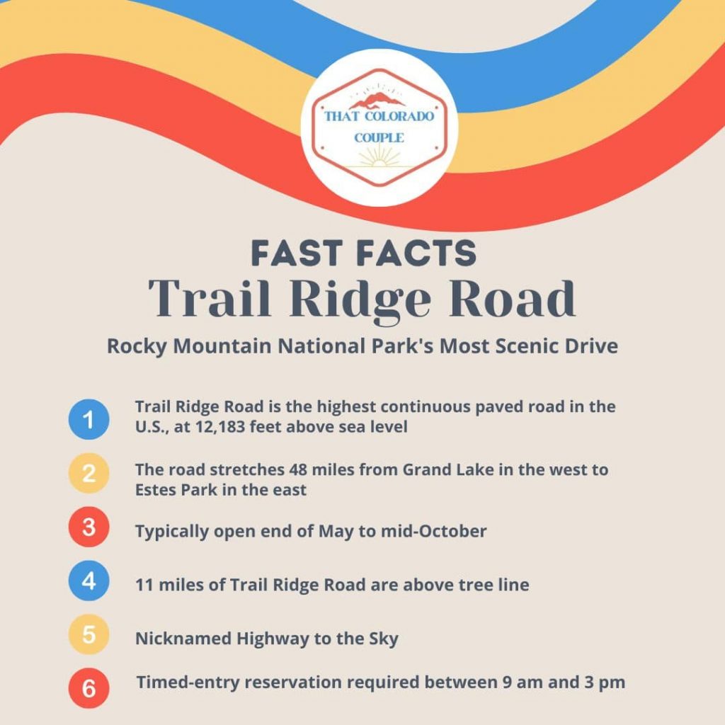
Trail Ridge Road reaches an altitude of 12,183 feet above sea level, earning its nickname “Highway of the Sky.” By comparison, Colorado’s capital city of Denver sits at 5,131 feet above sea level while New York City caps out at a whopping 33 feet. Not only will you be driving across mountaintops you’ll also traverse the entire Rocky Mountain range in as little as 2 hours.
Whether you’ve been driving in the mountains for years, or if this will be your first time, this guide to Trail Ridge Road has everything you need to know to enjoy your adventure on one of Colorado’s most iconic scenic drives.
Trail Ridge Road Fast Facts
Preparation
Before you even enter Rocky Mountain National Park, there are several important things you should remember to do in order to have a safer and stress-free drive on Trail Ridge Road.
Gas
There are plenty of gas stations in both Grand Lake and Estes Park, so whether you enter Trail Ridge Road from the west or east, you should make sure to fill your gas tank up beforehand. There are no gas stations inside Rocky Mountain National Park!
Weather
The weather in the mountains is erratic, to say the least! You can experience extreme changes in temperatures and conditions all on the same day. Since Trail Ridge Road ascends 5000 feet from its lowest to highest points, you’ll notice vastly different temperatures as your elevation changes. Expect it to be up to 20 degrees cooler at the road’s highest point than where you started in Estes Park or Grand Lake.
We recommend packing a variety of layers, including a rain jacket. In summer, when the road is open, it’s common for afternoon thunderstorms to roll in. As a general safety guideline, it’s best to avoid being outside above the tree line if there are any signs of rain or lightning. Lightning is attracted to the highest points, and being exposed to the tundra leaves you vulnerable to being struck. That said, it’s generally safe to drive Trail Ridge Road in the afternoons, and if you’re unsure if a particular area or trail is safe, ask a Park Ranger at one of the Visitor Centers or Entrance Station on your way in.
You should also check current conditions and read up on any alerts and closures on the national park service’s official website before your visit!
Want to see what Trail Ridge Road looks like right now? Like this very minute? Check out the webcam broadcasting live from the Alpine Visitor Center.


Altitude Sickness
If you’re visiting Rocky Mountain National Park from a lower elevation, you may feel the impact of being at a high altitude. If you experience dizziness, fatigue, shortness of breath, and headaches, you have altitude sickness! The best thing to do is wait a few days upon your arrival to acclimate to the altitude before doing more strenuous hikes or activities. Drink plenty of water, rest, and wait for your body to adjust.
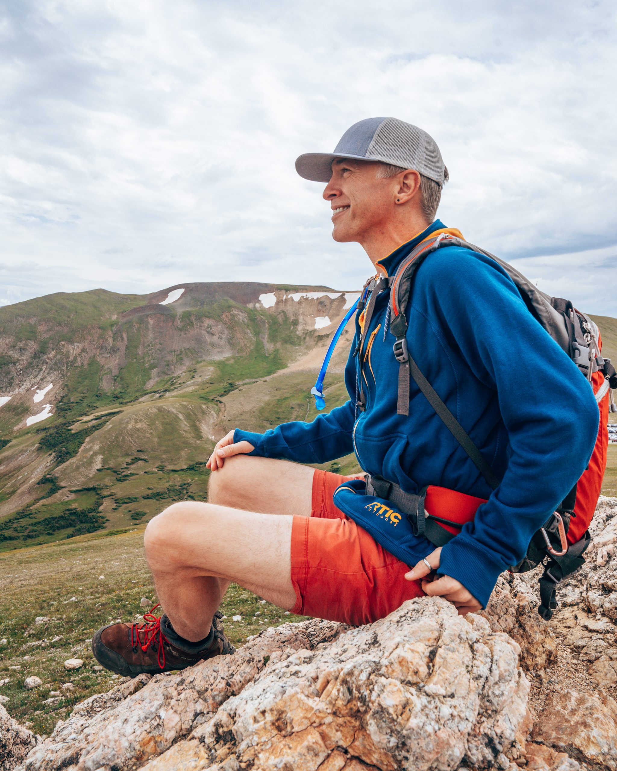
What to Pack for Trail Ridge Road
- Water bottle: Whether you are hiking or not during your trip to Trail Ridge Road, it’s so important to stay hydrated. This REI water bottle comes in so many fun patterns and is a great size for carrying with you on a scenic drive.
- Sun Protection: This is so important even if you are spending most of the day in the car! Because the sun is so intense at high altitudes, even if you’re just hopping out to check the viewpoints, you still risk getting sunburnt. Sun Bum is our favorite sunscreen brand.
- Sunglasses: I love these wooden frame sunglasses, so they are my go-to.
- Moisture-wicking layers: Even in the summer, it gets chilly on Trail Ridge Road because of the high altitude! SmartWool is our favorite layering brand. I wear this pullover all the time and their wool t-shirts are great base layers. There are also SmartWool t-shirts for men!
- Jacket: Because of the high elevation of this drive, even in summer it can be really cold and sometimes rainy too! I always pack my Columbia jacket when in the mountains.
- Camera: I always bring my Sony a7iii on our adventures. You’ll definitely want to take pictures of the amazing scenery on Trail Ridge Road!
- Snacks: Clif Energy Bars are our favorite travel snack, for a good mix of carbs, fats, and protein to power us through big days!
How long does it take to drive Trail Ridge Road?
Without stopping, you can drive the full 48 miles of Trail Ridge Road in an hour and 40 minutes. We recommend stopping as much as your schedule allows to make the most of the scenic drive. To see the majority of the stops and viewpoints and do one or two short (less than 2 miles) hikes, we recommend allocating half a day or more for driving Trail Ridge Road. Keep reading for our suggestions on which spots you definitely won’t want to miss!
Can you turn around on Trail Ridge Road?
Yes! Trail Ridge Road is a two-way road, and you do not need to drive Trail Ridge Road end-to-end. You can turn around at one of the many pullouts and parking areas throughout the road. The first time we drove Trail Ridge Road we were staying in Estes Park and went about 3/4 of the way to Grand Lake before turning around back to Estes Park, just to reduce driving time back and forth. The second time we drove Trail Ridge Road as a loop from our house, entering from Grand Lake and exiting through Estes Park.
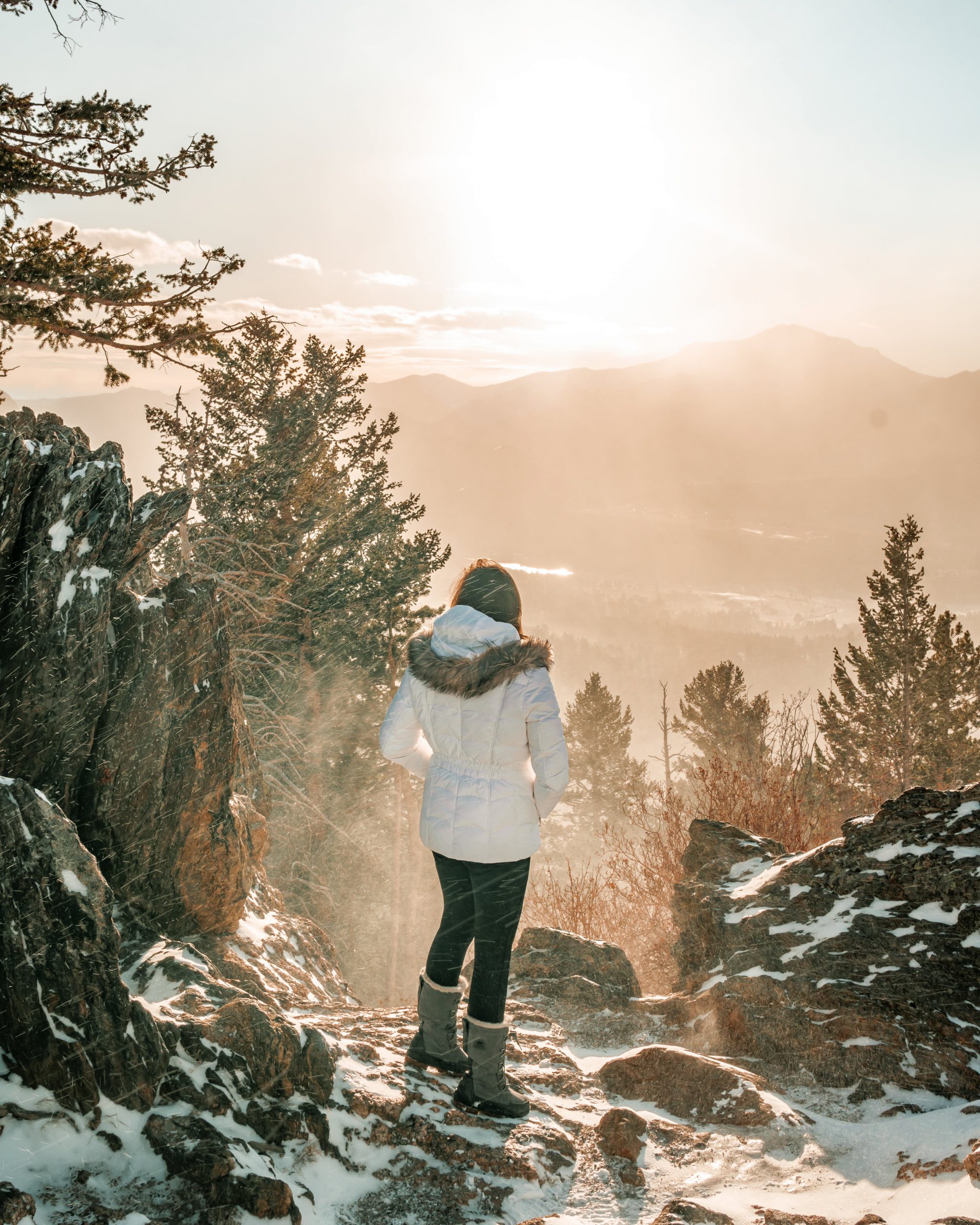
When is the best time to drive Trail Ridge Road?
In the winter months, Trail Ridge Road is closed to cars, however, you can hike or cross-country ski on the road. Trail Ridge Road usually opens on Memorial Day Weekend (the last weekend in May) every year, and typically closes mid-to-late October. The exact dates vary, though, so be sure to check out the National Park Service’s official page for Rocky Mountain National Park. A small part of Trail Ridge Road to the Many Parks Overlook remains open in winter to vehicles, and the remainder of the road is open for snowshoeing and skiing only.
Weather can vary wildly regardless of whether you drive Trail Ridge Road in June or October. In the summer, there are often afternoon showers and thunderstorms, so for the best chance for good weather, early in the morning is where it’s at!


Are reservations required to drive Trail Ridge Road?
In short – YES! A timed-entry permit is required to enter Rocky Mountain National Park between 9:00 am and 2:00 pm from the end of May to early-to-mid October. The timed-entry permit is in addition to the park admission fee of $30 per vehicle for one day. You can also use a national park pass like America the Beautiful pass for admission to Rocky Mountain National Park, but you still need a timed-entry permit even if you have a park pass!
Is it scary?
Ok, we’ll be honest! Driving Trail Ridge Road is a little scary. The road has steep drop-offs at points, and curves through switchbacks with dizzying views. Plus, there is frequent wildlife near the road, so it’s important to drive cautiously! That said, Trail Ridge Road isn’t necessarily any less safe than other roads. Just keep your eyes on the road, drive the speed limit or a speed you are comfortable with, and enjoy the drive!
Oh, and try to wait a few days after you arrive in Colorado before driving Trail Ridge Road to acclimate to the altitude. Driving this road while fatigued or with a headache would be very unpleasant, and potentially unsafe if you start to feel woozy!
Hikes on Trail Ridge Road
You can do so many hikes, both longer and shorter on Trail Ridge Road. From west to east (Grand Lake to Estes Park), here are the trails you can explore along this scenic drive.

| TRAILHEAD | DESCRIPTION | DISTANCE (ROUND TRIP) | ELEVATION GAIN |
|---|---|---|---|
| Green Mountain | Features wildflowers, as well as an opportunity to witness the remains of wildfire damage from the Troublesome Fire in 2020. | 3.5 miles | 705 ft |
| Onahu Creek | Features wildlife viewing opportunities, particularly moose and elk. Scenic bridges, a bubbling creek are highlights of the first half of the. The second half shows the burn damage from the Troublesome Fire. | 8.0 miles | 1322 ft |
| Coyote Valley (Kawuneeche Valley Colorado River) | Easy trail with Colorado River views, open meadows, and pines. | 1.3 miles | 26 ft |
| Baker Pass via Baker Gulch | Baker Pass features a meadow and wildflowers, snowcapped peak views, and the possibility of seeing moose. | 12.6 miles | 2497 ft |
| Timber Lake | Elk are often near the trailhead of this alpine lake hike. | 10.9 miles | 1408 ft |
| Colorado River (Lulu City Trail) | Good wildlife viewing opportunities for marmots, moose, pika, and deer. Features views of the Colorado River and meadows. | 7.8 miles | 826 ft |
| Alpine Ridge | Starts and ends at the Alpine Visitor Center. The trail is paved with many stairs leading to tundra and mountain views. | 0.7 miles | 147 ft |
| Toll Memorial via Tundra Communities | Trail is paved and wide enough for strollers and wheelchairs, though quite steep at times. Features mountain and tundra views, and the toll memorial at the end of the trail. | 1.1 miles | 154 ft |
| Ute Trail – Tombstone Ridge | Rocky trail features mountain views and wildlife viewing opportunities, particularly for elk and marmots. | 5.6 miles | 1912 ft |
| Deer Mountain | Trail features mountain views as well as a view of Estes Park. | 6.0 miles | 1400 ft |
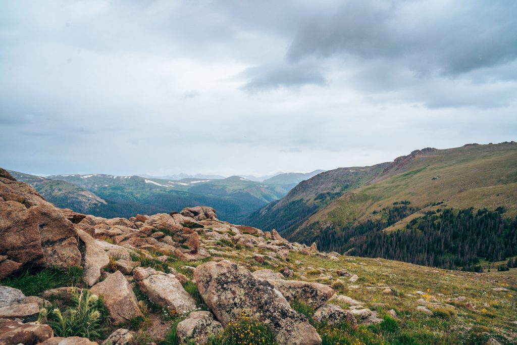
Best Stops on Trail Ridge Road
There are plenty of overlooks on Trail Ridge Road to fill up an entire day of exploring! While we think each of these is worth a stop, we’re providing all the details on each stop and what you’ll find there to help you prioritize stops for your itinerary!
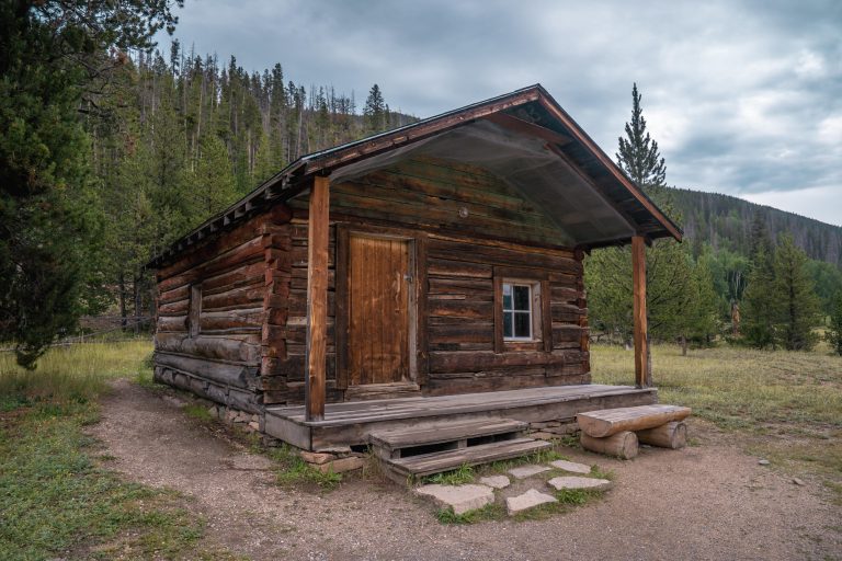
Holzwarth Historic Site
Elevation: 8,944 ft
The Holzwarth Historic Site gets its name from John Holzwarth Sr. and his family who built a ranch at this location in 1917. Interpretative boards detail the challenges of ranching in this remote location. Eventually, they redeveloped the ranch to be a destination fishing ranch called the Hozlwarth Trout Lodge.
The site features a stroller-friendly path with views of the Kawuneeche Valley. We were surprised to learn the small stream here is actually the Colorado River – the very same mighty river that carved out the Grand Canyon. The Colorado River starts right here in Rocky Mountain National Park as the modest creek you can see here at the Holzwarth Historic Site. Across the bridge over the Colorado River, you can visit the preserved cabins from the Holzwarth ranch. At certain times, you can also go into one of the cabins and learn more about the site’s history from one of the park’s volunteers.


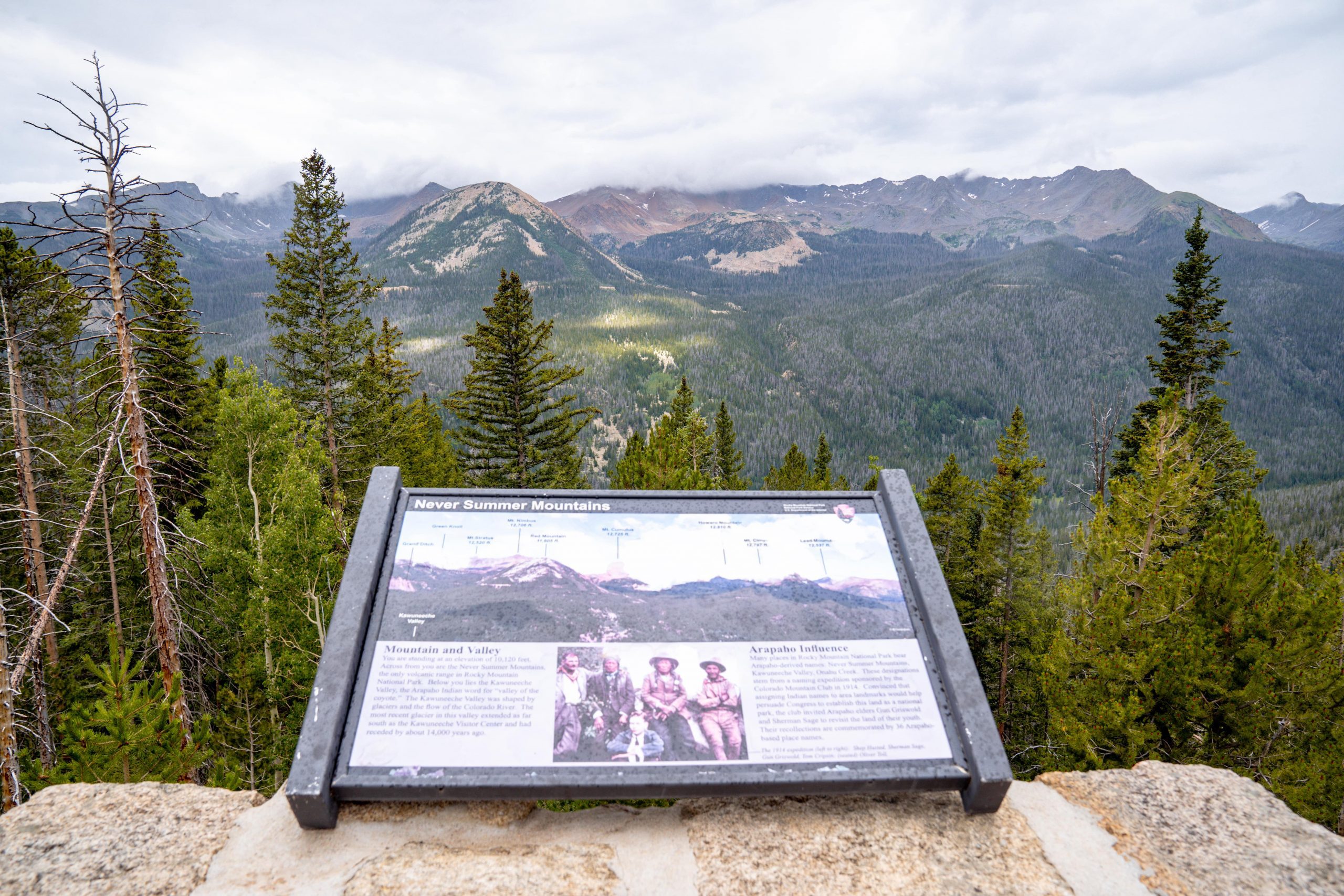
Fairview Curve Point
Elevation: 10,148 ft
Fairview Curve Point is the best place to view the Never Summer Mountain Range. This is the only volcanic mountain range in all of Rocky Mountain National Park. The Never Summer Mountains earn their name from Native Americans who lived in the area and observed that the highest peaks remained snowcapped even in summer.
You can also see the Kawuneeche Valley and the Colorado River down below, and if you look very closely on a clear day, you may spot a “scar” in the mountain known as the Grand Ditch. This faint horizontal line across the mountain range is the result of an 1890 water project that still provides water to farmers and communities in the Eastern Plains.
Milner Pass and the Continental Divide
Elevation: 10,759 ft
Milner Pass is where Trail Ridge Road crosses the Continental Divide, which stretches North and South America from Alaska all the way to Chile. Along this line, whether a raindrop eventually flows to the Atlantic or the Pacific Ocean is determined by which side of the line it falls. It can be a difference of mere feet, yet this small difference determines the entire trajectory of where the water will eventually end up! Mind-blowing!
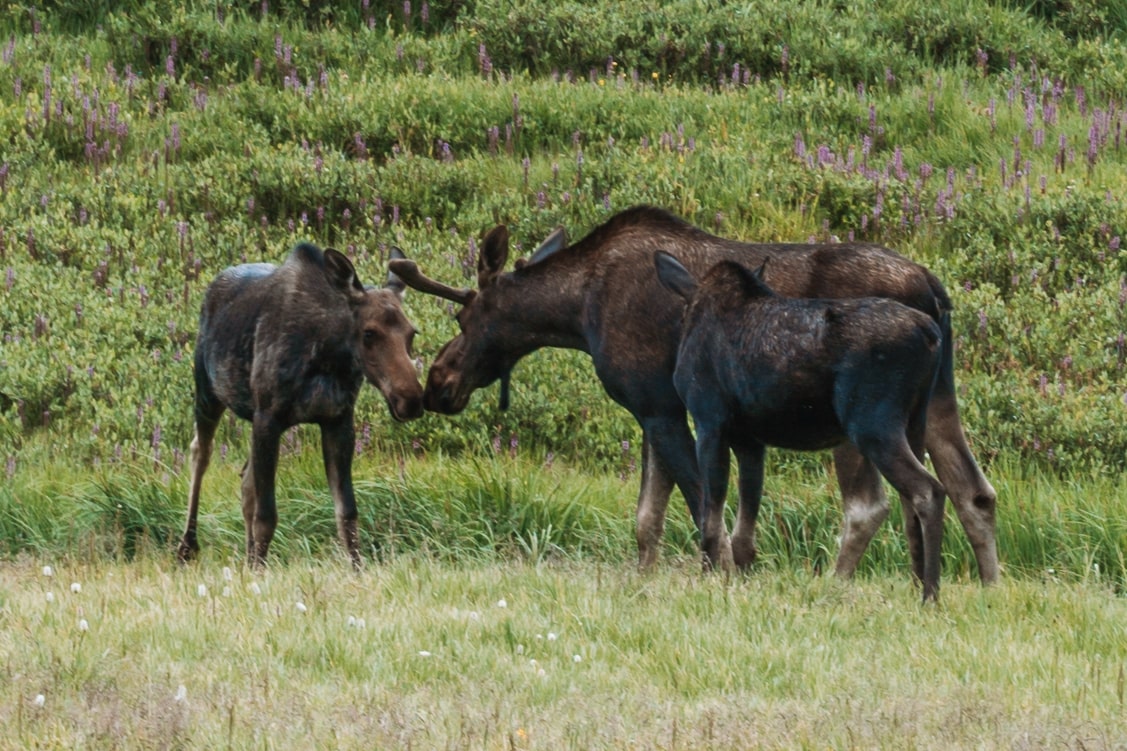
Don’t miss views of Poudre Lake here, and keep your eyes open for wildlife. We spotted a delightful family of moose grazing near the lake and had the privilege of observing them for several minutes before the two adults and one baby moose went together into the forest.


Medicine Bow
Elevation: 11,640 ft
Medicine Bow Overlook is a hairpin curve on Trail Ridge Road that provides a panoramic view of the Never Summer Mountains (previously known as the Medicine Bow Mountains). This overlook is above the tree line, meaning it is at such a high elevation that trees simply do not grow here due to the lack of oxygen.
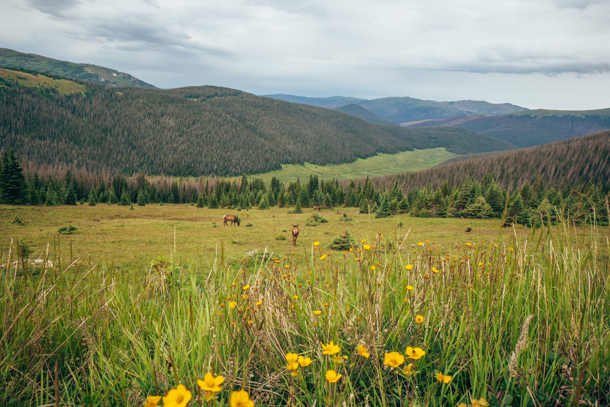
Take your time surveying the scenery here, especially the surrounding tundra where you have a good chance of spotting elk and marmots!
Look to your north, and on a clear day, you can see all the way to Wyoming. To the west, you can see a number of mountain tops, including the cloud-themed mountain tops of Mt. Stratus, Mt. Nimbus, and Mt. Cumulus.


Trail Ridge Road Alpine Visitor Center
Elevation: 11,796 ft
The Alpine Visitor Center is the highest-elevation visitor center in the entire National Park System. In addition to a small exhibit, ranger information desk, and gift shop, the visitor center is also home to the Trail Ridge Store, a larger, more commercialized gift shop and cafe. We recommend stopping in for coffee or hot chocolate. It gets chilly up here, even in peak summer!
From the visitor center parking lot, the short (less than 1-mile round trip) hike on the paved Alpine Ridge Trail is well worth it for mountain and tundra views from above the visitor center. If you have more time or energy (we did not), you can also hike the Ute Trail to Milner Pass from the same lot.
If you’re up for a hike, the Ute Trail (described in the table above), starts here and ends at the Alpine Visitor Center.


Gore Range Overlook
Elevation: 12,048 ft
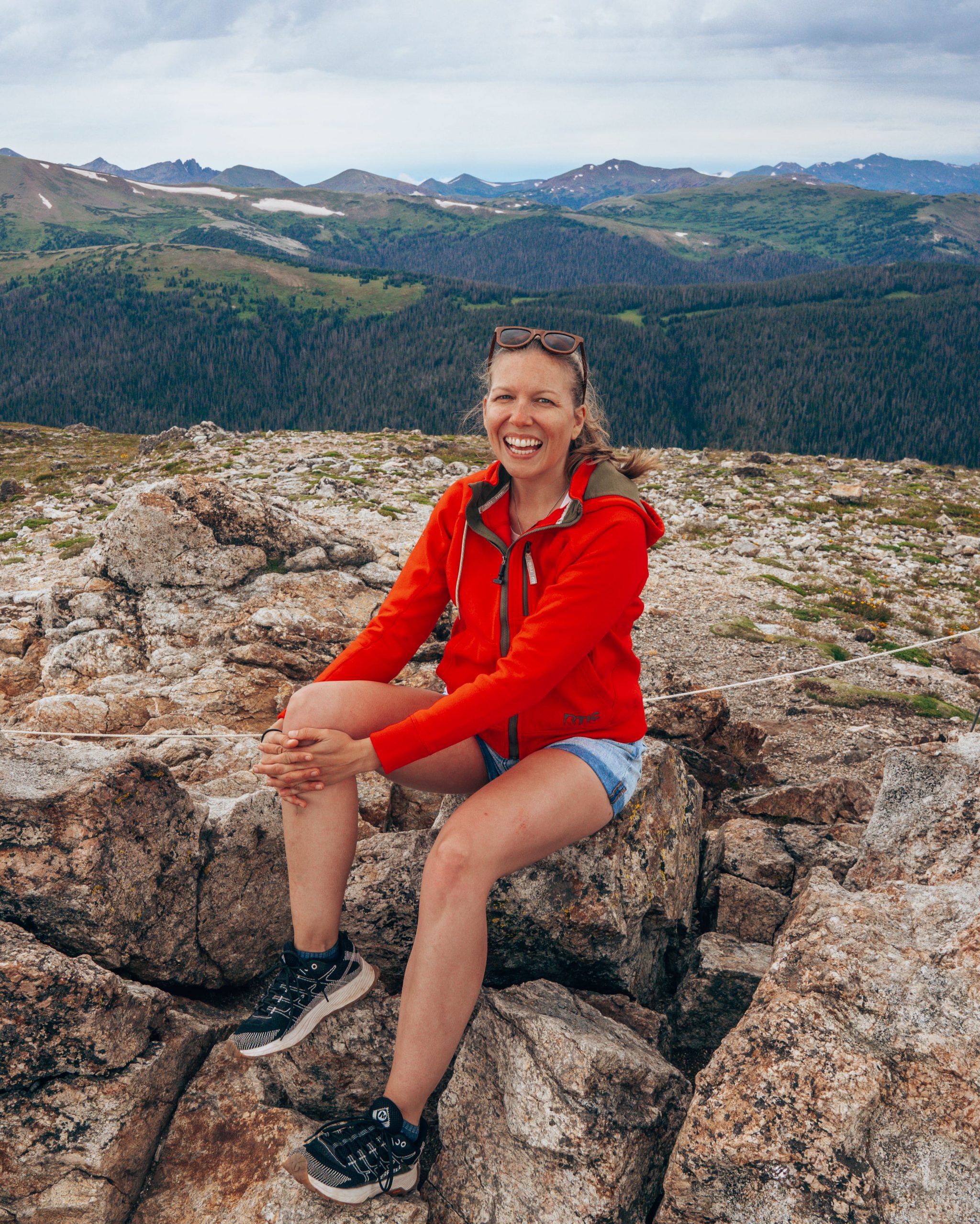
The Gore Range is 60 miles away, stretching from Steamboat Springs to Vail Pass, and perfectly on display here at the Gore Range Overlook. This western-facing overlook, named for an Irishman who went on a big hunting expedition (of course), is a must-see on Trail Ridge Road. From the Gore Range Overlook, you can see the flat top of Rocky Mountain National Park’s tallest peak, Long’s Peak, which stands a towering 14,259 feet above sea level. And lucky you, at this overlook, you are only a little over 2,000 feet below the park’s highest point. Soak it up! You are pretty much literally on top of the world here.


Trail Ridge Road Summit
Elevation: 12,183 ft
When you reach the Trail Ridge Road Summit, you’ll be at the highest point on the highest continuous paved road in the United States! There is not an overlook or pull-off here, so enjoy the views from your car and keep on driving.
Lava Cliffs Overlook
Elevation: 12,080
The Lava Cliffs Overlook is a small but worthwhile feature on Trail Ridge Road, and a rare opportunity to see volcanic rock somewhat up-close in Rocky Mountain National Park!
Approximately 28 million years ago, lava flow traveled here from the Never Summer Range (you know, the one you’ve been looking at all of these viewpoints!). Much later, glaciers carved through this area, cutting open the hillside and revealing the lava cliffs.
Keep your eyes out for Prairie Falcons and American Pipets which are often perched along the cliffs. You may also find elk here in mid-summer.

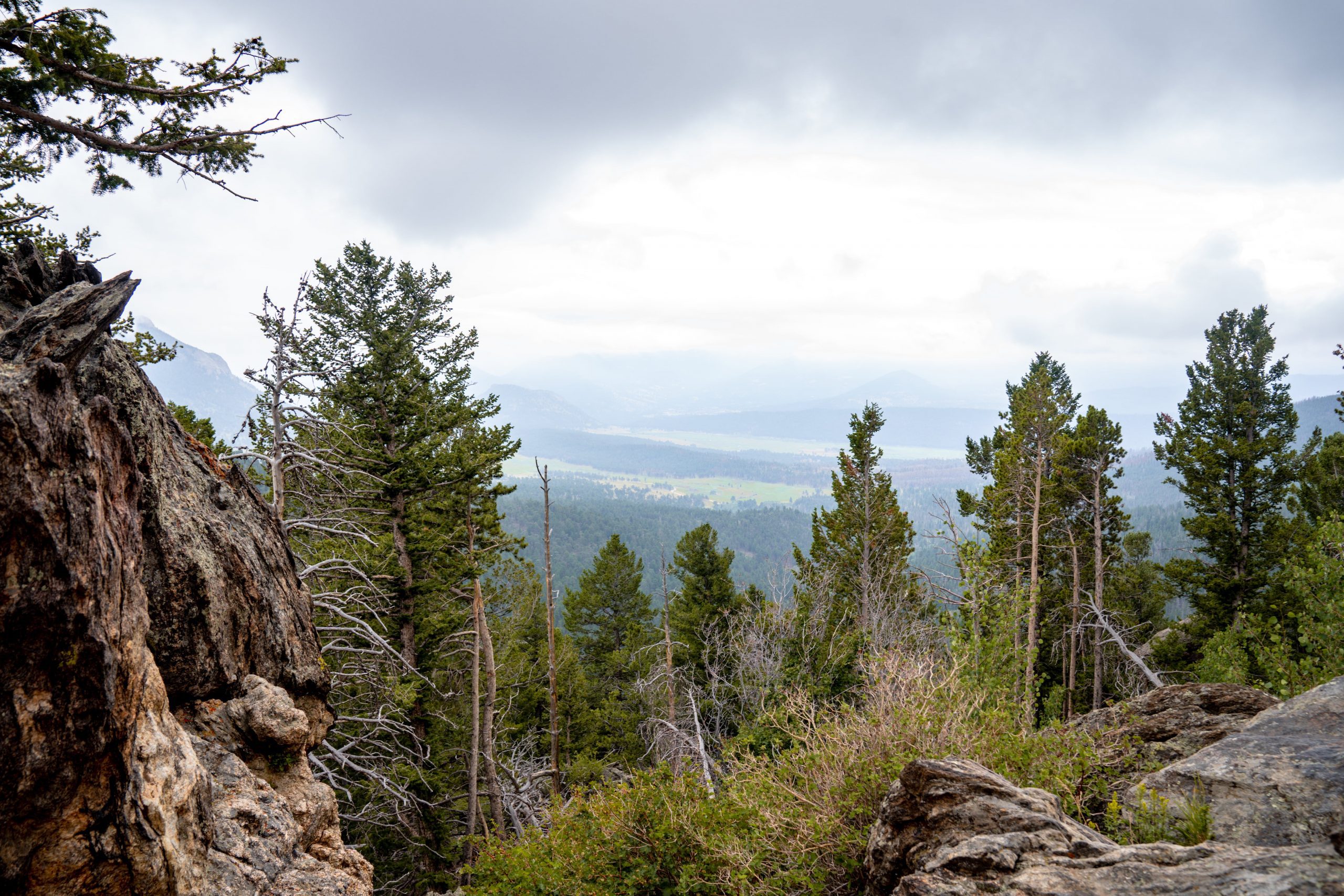
Forest Canyon Overlook
Elevation: 11,716 ft
The Forest Canyon Overlook is one of our favorite viewpoints on Trail Ridge Road. When we first visited in October of 2021, it was rainy and foggy but the views were still pretty good. When we returned in July 2022, it was much clearer and such a treat to finally see this vantage of the impressive mountains that comprise the Continental Divide and Forest Canyon below. Nearly 2,000 feet deep, Forest Canyon, like the Lava Cliffs, is another feature carved out by glaciers thousands of years ago.
A short 0.2-mile paved trail leads to the overlook, with interpretive signs along the way to provide more information about the view.


Rainbow Curve Overlook
Elevation: 10,875 ft
Rainbow Curve Overlook offers a grand view of the mountains, and sits in a unique position on the tree line, the dividing line between where trees can grow and where they cannot! On a clear day, you can see Horseshoe Park, the Alluvial Fan, and the Mummy Mountain range. We weren’t so lucky – our view was completely shrouded in clouds, which was admittedly pretty cool to see in its own way!

Many Parks Curve
Elevation: 9,691 ft
Many Parks Curve is the only viewpoint on Trail Ridge Road that remains open year-round. Just west of this viewpoint, the road closes for winter starting mid-October. Many Parks Curve features views of Mummy Mountain, Bighorn Mountain, Horseshoe Park, and the Alluvial Fan (the result of floods in 1982 and 2013).
Trial Ridge Road Map
Every viewpoint and hike mentioned in this guide are pinned on the map below. You can use it to plan your itinerary!
Where to Stay in Estes Park
We recommend basing yourself in Estes Park when visiting Rocky Mountain National Park. Here are some well-rated hotel options in Estes Park, which is just a few miles from the Beaver Meadows entrance station to RMNP.
Luxury
Midrange
- The Historic Crag’s Lodge
- Silver Moon Hotel
- Best Western Plus Silver Saddle Inn
- 4 Seasons Inn on Fall River
- Hotel Estes
Budget
Click here to search for additional hotels in Estes Park or search below!
Where to Stay in Grand Lake
Since Trail Ridge Road connects Grand Lake and Estes Park, it is also a great base for visiting Trail Ridge Road and the western portion of Rocky Mountain National Park. Don’t miss our post on the best hikes in Rocky Mountain National Park to see our recommendations on the best hikes in Grand Lake.
Relative Luxury
Midrange
Guided Tours in Rocky Mountain National Park
Not sure if self-driving to Trail Ridge Road and exploring Rocky Mountain National Park on your own is right for you? Check out some of these guided tours you can book to make the most of your experience in RMNP!
Final Thoughts on Trail Ridge Road
If you’re visiting Colorado in the summer months when Trail Ridge Road is open, make sure to add it to your Rocky Mountain National Park itinerary! We absolutely love this drive and know it’s one we’ll do again and again as we continue to check off our Colorado Bucket List.
Ready to plan your Rocky Mountain National Park trip? Don’t forget you need a timed-entry reservation booked online in advance to enter the park between 9 am and 3 pm or to access Bear Lake Road between 5 am and 6 pm.
Wondering what to pack for Trail Ridge Road and the rest of Rocky Mountain National Park? We’ve got you covered there too! Subscribe below to get our PDF packing list, and check out our blog post on what to pack for Rocky Mountain National Park!
Looking for more recommendations in Rocky Mountain National Park? Don’t miss our hiking guides to Chasm Lake, Sky Pond, and Emerald Lake – three of the best hikes in the park!